Where we are going

Monday, August 30, 2010

Jim Jim Falls

We are still in Kakadu and today we went to Jim Jim Falls. They are not flowing as it is the dry season, but when they are flowing - the wet season - you can't go there as the road is closed! They are the symbol of Kakadu, if you don't count the magnificent Aboriginal art, which many seem to overlook.
We decided to go despite the dire warnings about the state of the road. Its 55 kms of corrugated dirt, with the last 10 being serious 4 WD with deep sand, high conservation mounds and creek crossings. That was fine but it was the last 1 km walk, or rather boulder hopping that undid me. I find it so hard to jump from rock to rock, having to calculate every step, now that I am approaching 60! Just when I was all jumped out, we arrived at a magnificent canyon where the falls would have been if they had been - falling, that is. There was a little beach area, in full sun, and further upstream, a deep swimming hole, in the shade. It was absolutely beautiful.
We leave Kakadu reluctantly tomorrow and should be in Darwin on wednesday with full internet I hope so I can upload some photos.

Friday, August 27, 2010

Amazing Kakadu

Since Borroloola, we have camped at Daly Waters (behind the famous pub), Katherine, where we visitied Nitmiluk National Park. That's what Katherine Gorge is known as these days. We did the three gorge cruise there which we reallyenjoyed. Then we moved up to the northern section of the park at Edith Falls. This was a really beautiful spot and a lovely swimming hole, which was very welcome as it has been very hot here. We moved north from Edith Falls into Kakadu. We had two nights bush camping at Gunlom Falls and we have had two nights here at Cooinda on Yellow Waters. We did the sunset Cruise and then were able to but a second cruise for an extra $10 each, so we chose the sunrise cruise. They were both wonderful experiences, but the sunset was prettier as it waas actually raining here this morning. It has been so very hot and does not cool down much at night. Last night there was a bit of cloud around and I had a big huntsman spider crawl on me - no, not pleasant. I said to Alan - if we were in Tasmania I would say that seeing a huntsman is a sign that it is going to rain, butI don't think that would apply up here as it doesn't rain here until October.
It waas so hot when we went to bed but about 1.30 tis morning it started to rain and it was still raining off and on this morning. This did cool things down temporarily and we did the Nourlangie Rock art walk in relative coolness. Tomorrow we move onto Jabaru and Darwin next week when I hope to upload more pictures and respond to those of you who have been making comments. Ithink you need a Google account(free) to be able to comment.

Wednesday, August 18, 2010

We are in the Northern Territory


After 9 weeks in Queensland, Alan and I have crossed the border today and are tonight camped in Booraloola in NT. since I last blogged though we have been to some wonderful places. We started our Stage 3 with a night in Normanton, then two in Karumba on the Gulf of Carpentaria. Here the sun sets over the Gulf in a spectacular manner and we have the photos to prove it. We did a cruise on the Norman River and saw some rare birds as well as visiting a barramundi hatchery where they breed the fish to restock all the rivers.
Leaving Karumba we started 5 nights of bush camping - at Lawn Hill and Riversleigh National Parks and then at a beautiful camp on the Nicholson River. We tested the solar panel well and truely and we came trough OK. We have been very isolated though and I feel starved for news. I have not read a newspaper for weeks. I was amazed at Normanton that there were no news papers and we have not been near a shop since then, except fuel stops; only a few days to the election and we have no idea how the campaign is going. We were able to vote at Normanton though.
This first photo is of Riversleigh where the fossil fields are. The top of this hill is apparently the bed of an ancient lake - the rest has eroded away. What's a holiday without a sunset photo! This is from the sunset bar at Karumba.

Wednesday, August 11, 2010

we have started phase 3


Well, Chris and Glenys departed for home today and Alan and I headed West on the start of Phase 3 of the trip -- from Georgetown to Darwin via the Savannah Highway and into Katherine and Kakadu.
It was a sad parting with the Torreys this morning and we spent last night discussing the higlights and 'bests' of the last 4 weeks.
Since I last blogged we have been to Undara Lava tubes and Cobbold Gorge. This photo was taken yesterday at the Gorge. We are standing in front of a pool with some small freshwater crocodiles in it. Tonight, Alan and I are at Normanton and we will vote here tomorrow before going up to the Gulf of Carpentaria tomorrow. We hope to catch some fish.

Thursday, August 5, 2010

more photos


This photo was taken in Lakeland National Park and shows the magnetic termite mounds and some grassy plains country. The next one is of Alan and Chris swimming at fruit Bat Falls. It was such a lovely spot, we stopped there on the way back too. I'm trying a third one on here - its Alan and I crossing a creek on the Old Telegraph Track.

At the Tip


After the Tip, where we are in this photo, we drove straight down the newer Peninsula Development Road, stopping at Fruit Bat Falls for a swim, and camping at Bramwell Station and Palmer River and Hann River Roadhouses. We had hoped tp go to Lockhart River, but the road was closed. We are now in Chillago which is a nice little mining town. Chris wrote his thesis on a hill here called Red Dome. which has since been mined into a big hole in the ground. We did a tour of the mine this morning, which was very interesting but hot. The other photo is some Quinkin Aboriginal rock at near Laura.

next installment


This is Chris fishing in the Delhunty River. It was a lovely spot, but no fish wanted to sacrifice themselves. In fact we have not caught anything since Alan's momentous Fraser Island effort. . . but not for want of trying.
I forgot to mention we went to Weipa before we went to the Jardine River. We needed some running repairs on the electric system of our car and we stocked up on groceries. We did the mine tour of the Bauxite mine which is really the only thing in Weipa!
We continued north from Jardine River and had 5 nights at the top. It is such an unusual place. The geography and vegetation are constantly changing - its not all tropical rainforest as I had expected. There are heathlands, plains, the rainforest and eucalyptus forests it quite surprising. There's Aboriginal History as well as WW II history and pioneer settlement stuff as well. We went to Thursday Island which was really different culturally to the Mainland. Chris and Glenys also went to Horn island which was a great WWII history but I was scared of the boat ride, so we didn't go. The other photo is a crashed Beaufort Bomber near Bamaga Airport. These planes were built in NSW railway workshops during the war years.
I have discovered that I can only upload two photos successfully per blog so I will post this and start another one with the Cape York photos.

at last . . . a real internet connection!


This is the first 'real' connection since Port Douglas, so I can relax and tell you what has been happening and upload some photos.
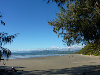
I told you about Port Douglas and Cooktown. Here are some photos. This is the beach at Port Douglas. Alan took it and I am one of those miniature people in the distance. The photo on the right is Cooktown - the view from Grassy Hill, where Captain Cook used to go everyday while the Endeavour was being repaired to work out how to get through the reef. He must have been fit as it was a steep climb in the heat!
After Cooktown we drove up through Lakefield National Park. The road was rough but passable and we acclimatised ourselves to the conditions. We camped one night at Kalpower Crossing and the second at Top Whip-handle Waterhole, which was nicer really as we were almost the only ones there.
Lakefield was also very pretty and we saw some beautiful waterholes with waterlillies.
Next we went over to the Old Telegraph Track (OTT), which was the original road up the Cape and the real 4 wheel drive stuff. We chickened out at the first creek crossing, and took the bi-pass road, getting back onto the OTT at a safer place! We camped for two nights at Bertie Creek, which involved a scary enough crossing for me!
The we camped at the north side of the crocodile infested Jardine River ( the high side). There were lots of people camped on the south side (low side) and they splashed, swam ( albeit briefly) and stood in the water to fish, but no crocodiles to be seen. Fortunate really, although Alan speculated on how much he could get for video footage of a camper being taken by a croc!